Aspects of Physical Geography of India: A Comprehensive Overview
GS-1, Unit-2, Sub Unit-2, HPAS Mains
India’s physical geography is one of the most diverse and complex in the world. Within a relatively compact geographical area, the country exhibits towering mountain systems, vast fertile plains, ancient plateaus, extensive coastlines, islands, deserts, dense forests, and varied climatic regimes. These physical features are not merely natural formations; they deeply influence India’s climate, river systems, soils, vegetation, biodiversity, settlement patterns, agriculture, and economic activities. Understanding the aspects of physical geography of India is therefore essential to comprehend the country’s environmental processes and human–nature interactions.
Geological Structure and Physiographic Divisions
The physical geography of India is rooted in its geological history. The Indian landmass consists of some of the oldest rocks of the world as well as some of the youngest mountain systems.
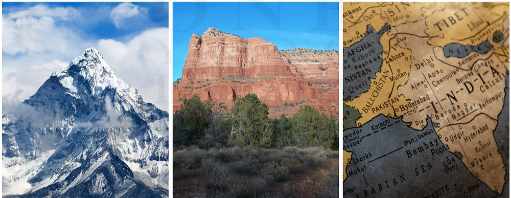
India is broadly divided into six major physiographic divisions:
- The Himalayan Mountains
- The Northern Plains
- The Peninsular Plateau
- The Indian Desert
- The Coastal Plains
- The Islands
Each of these divisions has distinct relief, structure, and geological origin, contributing to India’s extraordinary physical diversity.
The Himalayan Mountain System
The Himalayas form the northern boundary of India and are among the youngest fold mountains in the world. They were formed due to the collision of the Indian Plate with the Eurasian Plate.
Key characteristics:
- They act as a climatic barrier, preventing cold Central Asian winds from entering India.
- They give rise to major perennial rivers like the Indus, Ganga, and Brahmaputra.
- They influence the Indian monsoon system by forcing moisture-laden winds to rise and cause rainfall.
The Himalayas are divided into the Greater Himalayas (Himadri), Lesser Himalayas (Himachal), and Shiwalik ranges, each with unique topographical features.
The Northern Plains
The Northern Plains are formed by the alluvial deposits of the Indus, Ganga, and Brahmaputra river systems. These plains are:
- Extremely fertile
- Densely populated
- Agriculturally the most productive region of India
The plains are subdivided into the Punjab Plains, Ganga Plains, and Brahmaputra Plains. Their flat terrain, fertile soil, and availability of water have supported the growth of civilizations since ancient times.
The Peninsular Plateau
The Peninsular Plateau is the oldest landmass of India and is composed largely of igneous and metamorphic rocks. It is triangular in shape and relatively stable compared to the Himalayas.
Major features include:
- Central Highlands (Malwa Plateau, Bundelkhand, Chotanagpur Plateau)
- Deccan Plateau, flanked by the Western Ghats and Eastern Ghats
The plateau is rich in minerals such as coal, iron ore, manganese, and bauxite, making it the industrial backbone of India. Rivers like the Godavari, Krishna, and Kaveri originate here, though most are seasonal due to the plateau’s relief and climate.
Drainage System of India
India has a well-developed drainage system, broadly classified into:
- Himalayan Rivers (perennial): Indus, Ganga, Brahmaputra
- Peninsular Rivers (seasonal): Godavari, Krishna, Mahanadi, Narmada, Tapi
Himalayan rivers are long and form extensive floodplains, while Peninsular rivers flow through hard rock surfaces, creating waterfalls and gorges. Rivers play a crucial role in irrigation, hydropower generation, transportation, and cultural life.
Climate of India
India has a monsoon-type climate, characterized by seasonal reversal of winds. Major climatic seasons include:
- Cold Weather Season
- Hot Weather Season
- Southwest Monsoon Season
- Retreating Monsoon Season
Factors influencing India’s climate include latitude, altitude, distance from the sea, relief features, and pressure and wind systems. The monsoon is the most significant climatic phenomenon, as it determines agricultural productivity and water availability across the country.
Soils of India
Soils are the foundation of agriculture and vegetation. Indian soils are classified into several types:
- Alluvial Soil
- Black Soil (Regur)
- Red Soil
- Laterite Soil
- Desert Soil
- Mountain Soil
Each soil type is associated with specific crops and regions. For example, black soil is ideal for cotton cultivation, while alluvial soil supports rice and wheat production.
Natural Vegetation and Biodiversity
India’s varied relief and climate support diverse types of natural vegetation, ranging from tropical rainforests to alpine meadows. Major vegetation types include:
- Tropical Evergreen Forests
- Tropical Deciduous Forests
- Thorn Forests
- Mangrove Forests
- Mountain Forests
India is one of the world’s mega-biodiversity countries, hosting a wide range of flora and fauna across different physical environments.
Conclusion
The physical geography of India is a complex and interconnected system shaped by geological processes, climatic forces, and natural evolution over millions of years. Its mountains regulate climate, rivers sustain life, soils support agriculture, and vegetation maintains ecological balance. These physical aspects not only define India’s natural identity but also profoundly influence its economic activities, settlement patterns, and cultural development. A comprehensive understanding of India’s physical geography is therefore indispensable for appreciating the country’s environmental richness and addressing contemporary challenges such as climate change, resource management, and sustainable development.