Urbanisation, Industrialisation and Transport: A Geographical Analysis of India
GS-1, Unit-2, Sub Unit-2, HPAS Mains
India’s development trajectory is deeply influenced by the interlinked processes of urbanisation, industrialisation, and transport development. From ancient trade towns along river valleys to modern metropolitan regions connected by expressways and freight corridors, geography has played a decisive role in shaping economic and spatial patterns. In contemporary India, these three elements function as a mutually reinforcing system that drives growth, while also generating significant regional and environmental challenges.
Urbanisation in India: Spatial Patterns and Trends
Urbanisation in India has been gradual but uneven. According to the Census of India, the urban population increased from about 17% in 1951 to over 31% in 2011, reflecting the steady expansion of towns and cities. Geographically, urban growth has been concentrated in coastal plains, river basins, and plateau regions with better resource availability and connectivity.
Large metropolitan cities such as Delhi, Mumbai, Kolkata, Chennai, Bengaluru and Hyderabad act as urban primate centres, attracting population due to employment opportunities, education, and better services. Simultaneously, census towns and peri-urban areas have expanded rapidly, blurring the rural–urban divide. This pattern reflects the role of industry and transport in shaping settlement hierarchies across India.
Industrialisation and Location Dynamics
Industrialisation in India exhibits a strong spatial bias. Early industrial centres developed around raw material sources, ports, and transport nodes—for example, Mumbai (cotton textiles), Jamshedpur (iron and steel), Kolkata (jute), and Chennai (automobiles). These locations benefited from access to resources, labour, capital, and markets.
Post-independence planning promoted public sector industries and industrial dispersal through steel plants, industrial estates, and backward area development. However, liberalisation since 1991 has led to the emergence of industrial clusters, Special Economic Zones (SEZs), and industrial corridors, such as the Delhi–Mumbai Industrial Corridor (DMIC).
The rise of service-based and knowledge industries, particularly IT and biotechnology, has further influenced urban growth. Cities like Bengaluru, Pune, Noida and Gurugram exemplify how industrial specialisation reshapes urban landscapes, land use patterns, and migration flows.
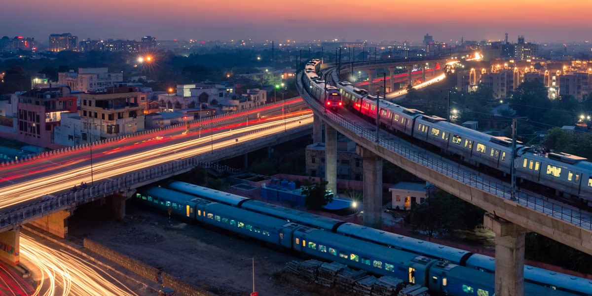
Role of Transport in Integrating Space
Transport acts as the critical link connecting urban centres and industrial regions. India’s vast transport network—comprising roads, railways, ports, inland waterways, and air routes—has historically determined the location and growth of settlements and industries.
The expansion of railways during the colonial period laid the foundation for industrial towns and port cities. In the post-independence era, projects such as the Golden Quadrilateral, Bharatmala, and Sagarmala have enhanced regional connectivity and reduced transport costs. Improved road and rail infrastructure has encouraged industrial decentralisation, leading to the growth of secondary cities and suburban industrial zones.
Recently, multimodal logistics and freight corridors, under initiatives like PM Gati Shakti, aim to integrate transport planning with industrial and urban development. These initiatives recognise that efficient mobility is essential for economic competitiveness and balanced regional growth.
Interrelationship between Urbanisation, Industry and Transport
Urbanisation, industrialisation and transport in India form a circular and interdependent relationship. Industrial growth generates employment, which fuels urbanisation. Expanding urban centres demand improved transport infrastructure for the movement of people, goods and services. In turn, better transport connectivity attracts further industrial investment, reinforcing urban growth.
For instance, the development of industrial corridors has led to the emergence of new urban nodes, logistics parks, and satellite towns. Similarly, metro rail systems and expressways have transformed intra-urban mobility, reshaping residential and commercial land use.
However, this interrelationship also produces spatial inequalities. Regions with inadequate transport infrastructure—such as parts of eastern and central India—lag behind in industrialisation and urban development, highlighting persistent regional imbalances.
Challenges and Sustainability Concerns
Rapid urban-industrial expansion has generated serious challenges, including urban congestion, pollution, housing shortages, and environmental degradation. Transport emissions contribute significantly to air pollution in Indian cities, while unplanned industrial growth strains land and water resources.
From a geographical perspective, sustainable development requires integrated planning, focusing on compact cities, public transport, green industrial practices, and regional balance. Strengthening tier-II and tier-III cities through better transport connectivity can reduce pressure on megacities and promote inclusive growth.
Conclusion
India’s experience demonstrates that urbanisation, industrialisation and transport are inseparable elements of geographical development. Their interaction has shaped settlement patterns, economic regions and social transformation across the country. While improved transport and industrial growth have accelerated urbanisation and economic progress, they have also intensified regional and environmental challenges. A geographically informed, integrated approach is essential to ensure that India’s urban and industrial future remains efficient, equitable and sustainable.